| IMS - Infrastructure Management System | ||
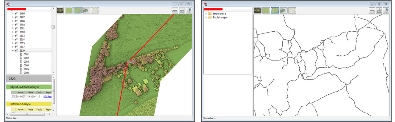
As a complimentary product for our customers, we include a convenient software application for easy access, visualization and browsing of our products. The customer’s existing data is preloaded into the application and used to spatially bind inspection information directly onto the existing objects (masts, spans, pipelines, roads...). |
The advantage of our software is that not only can it be used directly from the supplied hard drive without any installation, but also our clients do not need to have expensive third party software installed in order to use the data. |
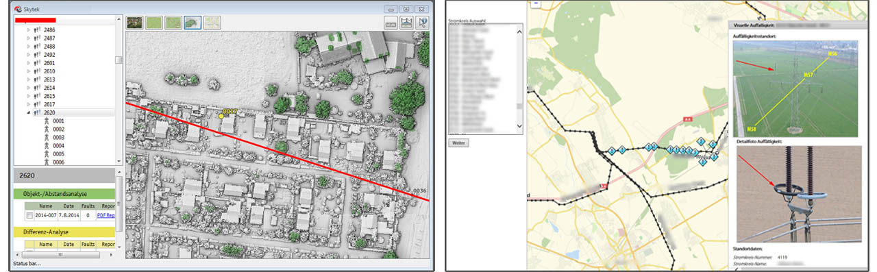
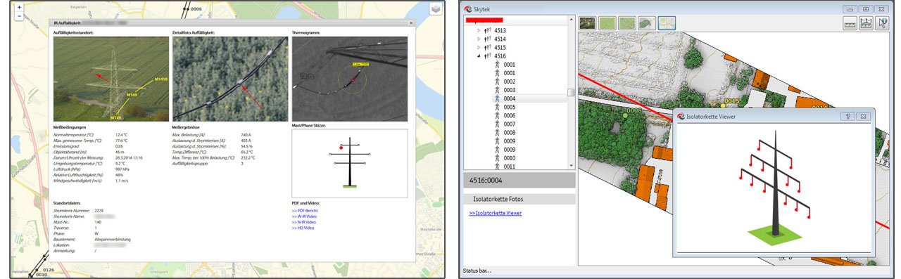
Users can quickly visualize up-to-date infrastructure data, display asset data such as tower location and specific tower assets, a line’s operating name, faults found during inspection, tower type etc. with the corresponding images and videos. All data is prepared and stored in standard industry formats, allowing advanced users to utilize the datasets in other software applications. |